Blogs
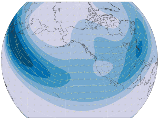
A robust El Niño is developing in the tropical Pacific, and we’re looking ahead to potential impacts on winter weather and climate. For specifics on this upcoming winter, you’ll have to wait for next month, when NOAA CPC will release their winter outlook. Today, I’m going for the big picture—how does the temperature of the surface of the tropical Pacific, thousands of miles away, change rain, snow, and temperature patterns over North America? The short answer: by shifting the location and strength of the jet stream.
Let’s back up a bit, though. Any time we talk about the jet stream, we first need to define what we’re talking about, before getting into changes in its behavior and how that …
Read article
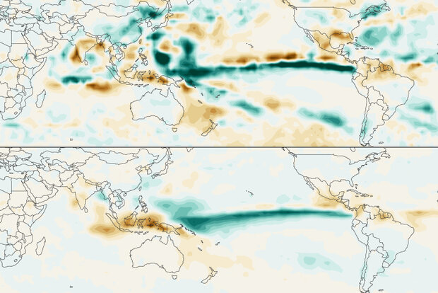
Let’s cut right to the chase. According to the September El Niño-Southern Oscillation (aka ”ENSO”) Outlook, El Niño is expected to stick around (with greater than a 95% chance) at least through January-March 2024. There is now around a 71% chance that this event peaks as a strong El Niño this winter (Oceanic Niño Index ≥ 1.5 ˚Celsius). Remember, though, a strong El Niño does not necessarily mean strong El Niño impacts locally. Instead, it means a stronger chance that El Niño impacts will occur.
Let’s dive deeper into what’s going on across the Pacific in a patented ENSO Blog expert Q&A. And boy, oh boy, are you not going to believe who we were lucky enough to snag. Without further ado…
Read article
This is a guest post by Dr. William Sweet and colleagues Dr. Greg Dusek, Dr. John Callahan, Analise Keeney and Karen Kavanaugh with NOAA’s National Ocean Service who are advancing the science and services to track and predict coastal flood risk in the face of sea level rise.
Flooding of U.S. coastlines due to sea level rise is a reality, plain and simple. This is referred to as high-tide flooding, and it’s distinguished from flooding caused by crashing waves or extreme rainfall. High-tide flooding in the U.S., which is measured by NOAA tide gauges that continuously record surrounding water levels (1), occurs nearly three times as often today as it did in 2000, and the frequency is a…
Read article
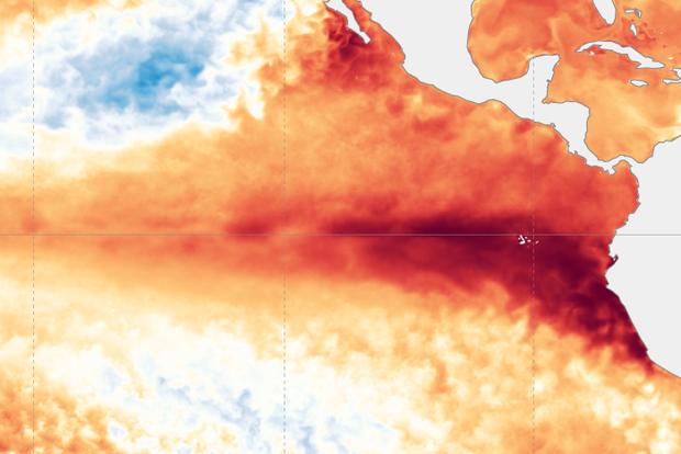
It’s that time again! And by “that time,” I mean the El Niño forecast update, of course. The chance that El Niño—the warm phase of the El Niño Southern Oscillation (aka “ENSO”) climate pattern—will continue through the winter is greater than 95%, so let’s sharpen our pencils and get into the details of what that means for upcoming seasons.
Mathematics
Greater than 95% is a very strong chance! Forecasters’ confidence that El Niño will continue is based on a few factors. First, the east-central tropical Pacific is quite warm. Specifically, our primary El Niño-monitoring metric, the Niño-3.4 Index—the average sea surface temperature in the Niño-3.4 region in the east-central tropical Paci…
Read article
This is a guest post by Mike McPhaden, who is a senior scientist at NOAA Pacific Marine Environmental Laboratory in Seattle, WA. Mike has previously blogged with us and was lead editor of the book “El Niño- Southern Oscillation in a Changing Climate” published by the American Geophysical Union. He has had a prolific career, including spearheading development of the Tropical Atmospheric Ocean (TAO) buoy array across the equatorial Pacific Ocean, which is key to observing and understanding ENSO.
For more than 30 years, climate researchers have been puzzling about how human-forced climate change affects the El Niño Southern Oscillation (ENSO), the warm phase of which we refer to as El …
Read article


