Heavy rains, record flooding in southern China
Details
More than a week of torrential rain in mid-September 2011 caused deadly floods across Sichuan, Shannxi, and Henan provinces in China.
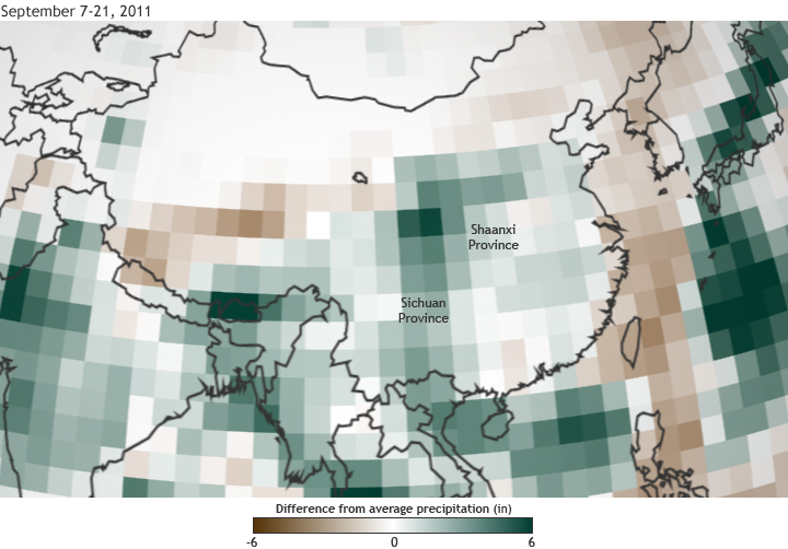
The map above shows differences from average precipitation across China for September 7-21, 2011. Shades of brown indicate areas that received up to six inches less than average precipitation, light colors indicate areas that received near-average precipitation, and green shows areas that received up to six inches more than average.
The floods were the worst in Sichuan since records began in 1847. According to a press release from Oxfam Hong Kong, a disaster relief group working in the area, the floods affected more than 21 million people, displacing more than a million people. Included in the estimated cost of 3.7 billion Yuan (580 million US$) in damages was the destruction of nearly 99,000 acres of crops.
Map based on daily composites of precipitation data from the NCEP/NCAR Reanalysis project, provided by NOAA Earth System Research Laboratory.
