Drought Impacts Continue to Pile Up
Details
Record-low hay stocks. Significant damage to house foundations. Ethanol and beef processing plants idled. Mandatory water restrictions. At least 25,000 dead pecan trees in one Texas county. Ski area employment down. The list of impacts from the U.S. drought seems endless.
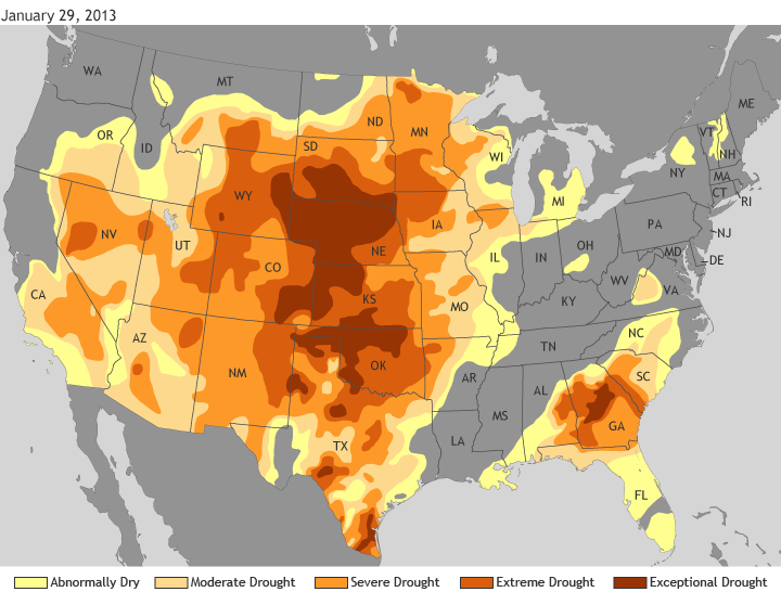
This map shows drought status across the United States as of January 29, 2013. Rain and snow have improved the drought somewhat in parts of the Midwest, the Ohio Valley, and the Deep South in the past 6-12 weeks, but areas of exceptional drought—the most severe category of drought —remain across the Great Plains and Georgia, with broad areas of extreme and severe drought across the West and Southeast.
According to the U.S. Drought Monitor, an estimated 58 percent of the contiguous United States was in some level of drought as of January 29, with an additional 12 percent in the “Abnormally dry” category. Stream flow forecasts for many major western rivers, including the Colorado and the Rio Grande, are below normal.
Map by Climate.gov team, based on data from the U.S. Drought Monitor Program. Reviewed by Jake Crouch and Deke Arndt, National Climatic Data Center.
Links
National Drought Impacts Reporter
