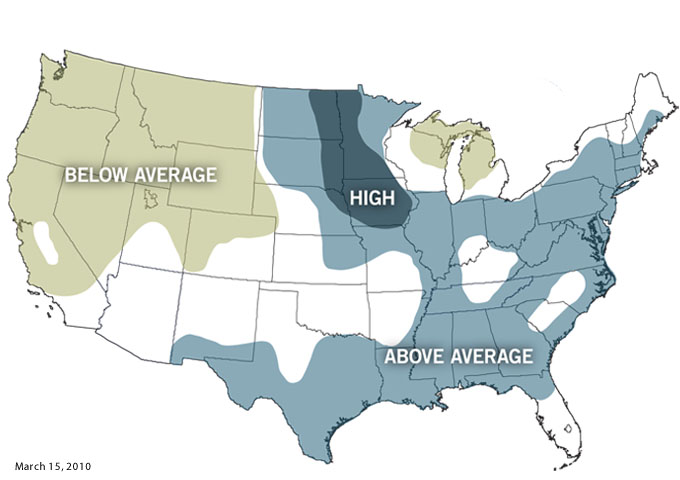
Above-average flood risk is forecast for one-third of U.S.
Details
Across the contiguous United States, more than a third of the land has an above-average risk of flooding this spring, according to an announcement issued on March 15 by NOAA’s National Weather Service. Major flooding has begun and is forecast to continue through spring in parts of the Midwest.
The highest threat for flooding this season is in the Dakotas, Minnesota, and Iowa. This includes areas along the north-flowing Red River, where floodwater levels could approach the records set just last year. Even though the historical odds that this region will have another major flood this spring are very slim, conditions indicate the opposite. Ten inches of snow on the ground usually melts to one inch of water, but across the Red River watershed, some areas of the snowpack contain even larger amounts. Additionally, the snowpack covers a larger area than it did in 2009.
The South and East are also more susceptible to more flooding than average after an El Niño-driven winter brought heavy snow and rains to these regions. The impacts of spring flooding will largely depend on how much additional precipitation these regions experience in the coming weeks, and how fast existing snow cover melts.
For more information, see the recent NOAA press release.
