Blogs
This is a guest post from Prof. Adam Sobel, Dept. of Applied Physics and Applied Mathematics & Dept. of Earth and Environmental Sciences, Columbia University. He has also started his own blog, adamsobel.org, and his book about Hurricane Sandy, Storm Surge, will be published by HarperCollins on October 14.
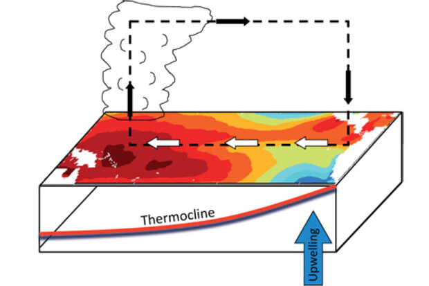
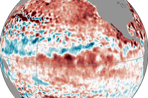
In mid-July 2014, Michelle hypothesized that the reason El Niño was having trouble getting started was that although eastern Pacific sea surface temperatures (SST) were above average, they weren’t being felt by the atmosphere (1). While the central and eastern Pacific were warm, so were the western Pacific and Indian Ocean—so the SST gradient was small (2)—and the gradient is one fac…
Read article
One of the best things about this blog is the number of excellent comments we get on each post. And after spending some time reading your comments for inspiration, I’ve come to several conclusions. One: people really care about the forecast for this winter and two: people are curious about climate change’s impact on ENSO. While I cannot tell you about snow this winter (full disclosure: I love snow and hope for a lot… everywhere. Always.), I can discuss the impact this grand experiment we have started with our atmosphere—climate change—could have on ENSO.
In short, if you are someone who wants more or stronger ENSO events in the future, I have great news for you–research supports that. If …
Read article
In this month’s ENSO Diagnostic Discussion, forecasters are again calling for an approximately 65% chance that El Niño will develop by the Northern Hemisphere winter–with a 55% chance it will start during September-October-November. If it seems like each month we’ve been saying “… in the next few months,” you may be wondering what’s going on. Isn’t an ENSO event (either El Niño or La Niña) supposed to develop in the late spring or summer, peak in the winter, and return to normal conditions in the spring? Generally speaking, yes. But, of course, it’s not always so simple.
ENSO is seasonally “phase-locked,” meaning the events do follow a seasonal cycle, due to a series of physical pro…
Read article
This is a guest post from Simon Wang, Utah Climate Center/Dept. Plants, Soils & Climate, Utah State University
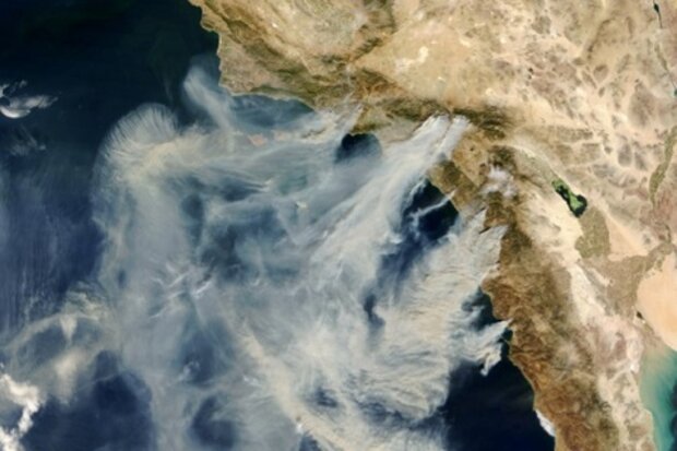
Scientists and natural resource managers are closely watching the potential development of El Niño as it might increase rainfall in California and bring relief to the severe drought there (see footnote 1). In the western United States, drought often brings a double punch: water shortfall plus wildfires. The West as a whole has experienced a relatively quiet fire season thus far, with fewer than 3 million acres burned between January 1-August 25 compared to the 10-year average of 5.4 million acres (see National Interagency Fire Center for more information). But California is w…
Read article
In our post last month, we introduced and defined several climate patterns other than ENSO that impact United States winter climate. But how useful are these climate patterns in predicting U.S. temperature and precipitation in winter and other seasons? How do they stack up against ENSO, for example?
Long-term Trends
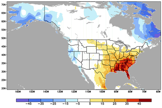
For all seasons combined, upward temperature trends have been observed across much of the U.S., especially in the northern and western regions (Fig. 1). The southeastern U.S. has had a slower warming trend (Livezey and Timofeyeva 2008).
Unlike the other climate patterns, this pattern of rising temperature is present in all seasons, not just winter, so it provides…
Read article


