File name: tchp_jun1_sept15_2010_720.jpg
Original Resolution: 720 × 310
File Size: 75 KB (MIME Type: image/jpeg)
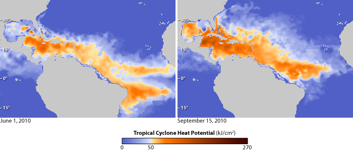
The maps above show the heat available to fuel tropical cyclones (the common name for tropical storms, hurricanes, and typhoons) in the Atlantic Ocean on June 1, 2010 (left), and on September 15 (right). Yellow and orange show places where the amount of available heat is enough (at least 50 kilojoules per square centimeter) to have a significant impact on the intensity of hurricanes, provided that atmospheric conditions are also favorable.
Darkest blue shows places where there was no hurricane heat potential; water temperatures were below 26°C (80°F)—the minimum temperature needed to sustain hurricanes.