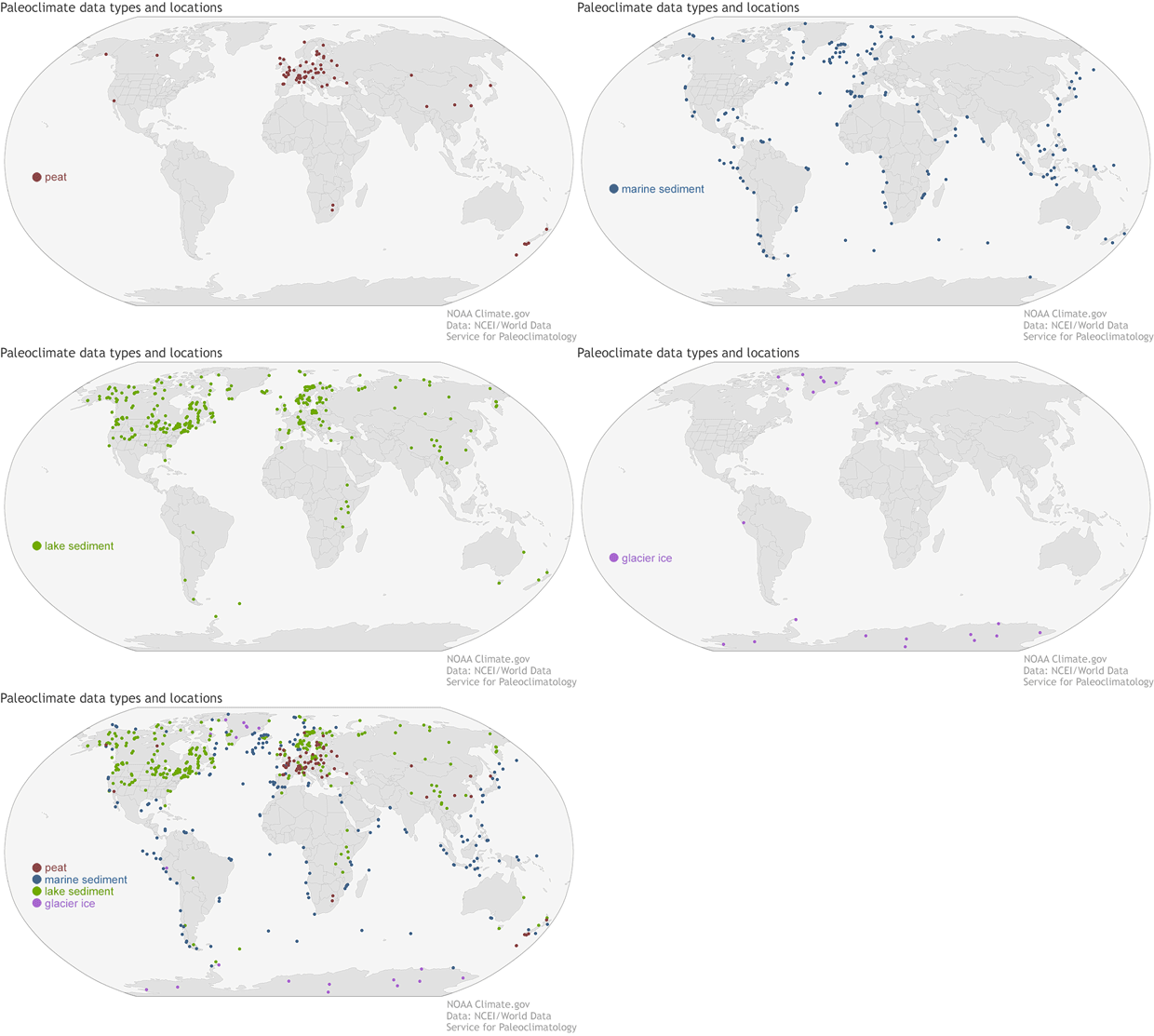
This animation shows the types of paleoclimate proxies in a new NOAA climate proxy database and the 684 sites they came from. Before ending with a map of all the sites, the animation cycles through four maps of the different material from which the proxy came: peat (maroon), partially decayed plant material found in marshy or damp regions; marine sediment (blue), lake sediment (green), and glacier ice (purple). The database results from a partnership between NOAA’s World Data Service for Paleoclimatology, the Cooperative Institute for Research in Environmental Studies, and a large team of international researchers led by scientists at the University of Northern Arizona. Climate.gov image using data from NCEI and NOAA’s World Data Service for Paleoclimatology.